
Circumpolar Arctic Vegetation Mapping Project
Overview
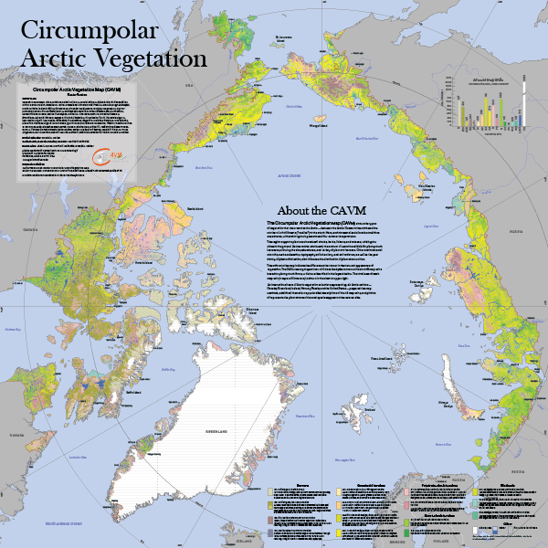
The Circumpolar Arctic Vegetation Map (CAVM) shows the types of vegetation that occur across the Arctic—between the Arctic Ocean to the north and the northern limit of forests (“treeline”) to the south. Here, environmental and climatic conditions are extreme, with a short growing season and low summer temperatures.
The region supports plants such as dwarf shrubs, herbs, lichens and mosses, which grow close to the ground. As one moves southward, the amount of warmth available for plant growth increases , allowing the size, abundance, and variety of plants to increase. Other environmental controls, such as elevation, topography, soil chemistry, soil moisture, and the past history of plant colonization, also influence the distribution of plant communities. The colors on the map indicate the differences that occur in the outward appearance of vegetation.
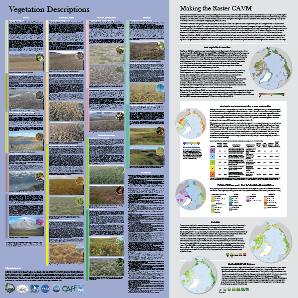
An international team of Arctic vegetation scientists representing the six countries of the Arctic—Canada, Greenland, Iceland, Norway, Russia, and the United States—prepared the map. Methods, additional thematic maps, detailed descriptions of the 16 map units, and photos of representative plant communities and species are on the reverse side.
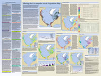
A raster verson of the Circumpolar Arctic Vegetation Map (Raster CAVM) map was published in 2019. It groups over 400 described plant communities into 16 vegetation types, glaciers, saline water, and freshwater at 1-km resolution. It builds on the strengths of the original CAVM, using the same legend, extent and projection, while providing a finer spatial resolution, raster format, and improved mapping of Arctic vegetation.
Read the Abstract to learn more
Products
Raster CAVM Journal Article
The Raster CAVM was the subject of an 2019 article in the journal Remote Sensing of Environment (Vol. 232, Open Access).
Citation: Raynolds, M.K. et al. 2019. A raster version of the Circumpolar Arctic Vegetation Map (CAVM). Remote Sensing of Environment 232:111297. doi:10.1016/j.rse.2019.111297.
Raster CAVM Poster
The Raster CAVM poster (1:7,000,000) is available as a PDF below and from the Arctic Data Center (doi:10.18739/A2RX93F75) at standard quality (with no bleed) and higher-resolution, press-ready quality (with 1/8" bleed).
Print copies of the double-sided 36" x 36" map are available from the Alaska Geobotany Center while supplies last. Contact us to request a copy.
Download Poster from AGC (36 x 36 inch, standard quality, no bleed).
Suggested citation: CAVM Team. 2024. Raster Circumpolar Arctic Vegetation Map. Scale 1:7,000,000. Conservation of Arctic Flora and Fauna, Akureyri, Iceland. doi:10.18739/A2RX93F75
Raster CAVM Data
Raster CAVM data (version 2) can be downloaded below and from Mendeley Data (doi:10.17632/c4xj5rv6kv.2).

Original CAVM
The 2003 Circumpolar Arctic Vegetation Map was the first vegetation map that covered the entire Arctic using a single unified legend. It has been widely used as a base map for studies in the Arctic and was the framework for terrestrial vegetation sections of the Arctic Biodiversity Assessment 2013 and many other applications. The CAVM was the subject of a 2005 article in the Journal of Vegetation Science (Vol. 16):
Citation: Walker, D.A., Raynolds, M.K., Daniëls, F.J.A., Einarsson, E., Elvebakk, A., Gould, W.A., Katenin, A.E., Kholod, S.S., Markon, C.J., Melnikov, E.S., N.G., M., Talbot, S.S., Yurtsev, B.A., CAVM Team 2005. The Circumpolar Arctic Vegetation Map. Journal of Vegetation Science 16:267-282. doi:10.1658/1100-9233(2005)016[0267:TCAVM]2.0.CO;2
The original CAVM poster and data are available to download below:

Download Poster • Download Data from AGC
Suggested Citation: CAVM Team. 2003. Circumpolar Arctic Vegetation Map. (1:7,500,000 scale), Conservation of Arctic Flora and Fauna (CAFF) Map No. 1. U.S. Fish and Wildlife Service, Anchorage, Alaska. ISBN: 0-9767525-0-6, ISBN-13: 978-0-9767525-0-9
Funding
- National Aeronautics and Space Administration (NASA)
- Arctic Boreal Vulnerability Experiment (Pre-ABoVE NNX13AM20G)
- Land Cover and Land Use Change (LCLUC NNG6GE00A, NNX09AK56G, NNX14AD90G)
- National Science Foundation (NSF)
- Arctic Science, Engineering and Education for Sustainability (ArcSEES 1263854)
- Arctic System Science (ARCSS 1737750)
- Arctic Sciences (ARC 0425517, OPP 9908-829)
- Arctic Transitions in the Land-Atmosphere System (ATLAS 9732076)
- Russian Foundation for Basic Research (Award 18-04-01010 А)
- U.S. Fish and Wildlife Service
- U.S. Geological Survey
- U.S. Bureau of Land Management
We appreciate the international support of the Conservation of Arctic Flora and Fauna (CAFF) Working Group of the Arctic Council for both the original Circumpolar Arctic Vegetation Map (CAVM) and the Raster CAVM.
See Credits for more acknowledgments