|
|
The
Sites
|
|
 |
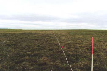
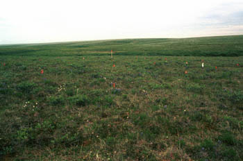
Barrow,
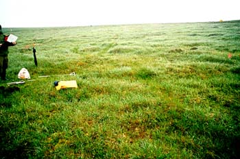
Arctic Coastal Plain (coastal acidic tundra) The site is located in Subzone 3 (N 71 19 17.6, W 156 36 29.3) on a fairly homogenous flat residual surface (unaffected by thaw-lake processes). Most of the surface is either featureless or has flat-centered ice-wedge polygons. The primary plant community is Saxifraga cernua–Carex aquatilis. This type commonly occurs on moderately drained, zonal sites near the coast and is dominated by graminoids (Alopecurus alpinus, Carex aquatilis, Dupontia fisheri, Eriophorum angustifolium, Poa arctica), forbs (Cardamine pratensis, Cerastium jenisejense, Chrysosplenium tetrandrum, Petasites frigidus, Saxifraga cernua, S. hirculis, S. hieracifolia, S. nelsoniana, Stellaria laeta and mosses (Oncophorus wahlenbergii, Polytrichastrum alpinum, Polytrichum strictum and Sarmentypnum sarmentosum). Prostrate and semi-erect willows (Salix rotundifolia, S. planifolia ssp. pulchra) are common in some areas. |
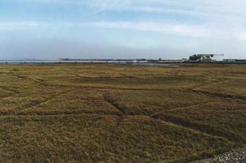 |
West
Dock, Arctic Coastal Plain (moist nonacidic tundra) The site is located on the Arctic coast within the Prudhoe Bay Oil Field in Subzone 3 (N 70 22 30.2, W 148 32 57.8). It is a fairly homogenous flat surface that is either featureless or has flat-centered ice-wedge polygons. The primary plant community is Carex aquatilus, Eriophorum triste, Dryas integrifolia, Salixovalifolia, Tomentypnum nitens, and Distichium capillacium (moist graminoid, prostate dwarf-shrub tundra). |
 |
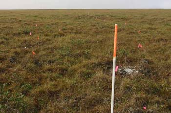
Atqasuk,
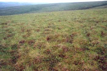
Arctic Slope (sandy acidic tussock tundra) This site is located in Subzone 4 (N 70 27 52.2, W 157 27 02.6) on a broad flat stabilized sandy plain near the west end of the Atqasuk runway. The site is notable for its total lack of nonsorted circles (frost boils). This is typical of tussock tundra in the sand region, but very unusual elsewhere on the Arctic Coastal Plain. The lack of cryoturbation promotes a leached soil and species-poor vegetation. The dominant community is tussock tundra with small tussocks (<15 cm high). Only six vascular species were recorded in the relevé of this site (Eriophorum vaginatum, Ledum palustre ssp. decumbens, Vaccinium vitis-idaea, Cassiope tetragona, Pedicularis lapponica, and Carex bigelowii). The moss canopy is poorly developed, and lichens are common between the tussocks, but generally in poor condition. In slightly moister areas, Carex bigelowii is the dominant sedge. |
 |
Deadhorse,
Arctic Slope (moist nonacidic tundra) This site is located just south of the town of Deadhorse in Subzone 4 (N 70 09 42.4, W 148 27 49.6). The site is flat, and moderately well drained. The primary plant community is Eriophorum triste, Carex membranaceae, Dryas integrifolia, Salix arctica, Tomentypnum nitens, and Distichium capillacium (moist graminoid, prostate dwarf-shrub tundra). |
 |
Franklin
Bluffs, Arctic Slope (moist nonacidic tundra) This site is located along the Dalton Highway in Subzone 4 (N 69 40 29.5, W 148 41 35.0) on a relatively flat surface that ranges from standing water to dry conditions. The majority of the site is mesic, and the primary plant community is Eriophorum triste, Carex membranaceae, Eriophorum vaginatum, Dryas integrifolia, Salix arctica, Tomentypnum nitens, and Drepenocladus uncinatus (moist graminoid prostate dwarf-shrub tundra). |
 |
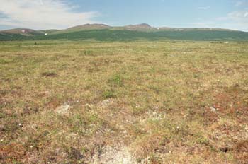
Oumalik
1/MNT, Arctic Slope (moist nonacidic tundra) This site (Figure 6) is located in Subzone 4 just north of the MNT-MAT vegetation transition boundary from Subzone 4 to Subzone 5, at the northern edge of the Arctic Foothills (N 69 43.95, W 155 51.78). The site is a nonacidic loess site on a gentle slope (6-8�). Dominant species in the grid are Dryas integrifolia and Carex bigelowii. There are abundant low shrubs of Salix glauca 25-30 cm tall. |
 |
Oumalik
2/MAT, Arctic Slope (moist acidic tundra) This site (Figure 7) is located in Subzone 5 just south of the MNT-MAT boundary (N 69 44.12, W 155 52.17). The dominant species include Eriophorum vaginatum and Betula nana. The MAT site is about 1/2km south of the Oumalik-1 on an ecotone between MNT and shrubby MAT. |
 |
Sagwon
MNT, Arctic Slope (moist nonacidic tundra) This site (Figure 8) is located in Subzone 4 just north of the MNT-MAT vegetation transition boundary from Subzone 4 to Subzone 5, on the top of a hill (N 69 26 00.3, W 148 40 12.3). The site is mesic, and the primary plant community is Carex bigellowii, Erophorum vaginatum, Dryas integrifolia, Salix reticulata, Salix richardsonii, Tomentypnum nitens, and Hylocomium splendens (moist graminoid, prostate dwarf-shrub tundra). |
 |
Sagwon
MAT, Arctic Slope (moist acidic tundra) This site (Figure 9) is located in Subzone 5 just south of the MNT-MAT boundary (1 km south of Sagwon MNT), on a 3 degree slope just below the crest of a hill (N 69 25 32.6, W 148 41 33.6). The site is mesic, and the primary plant species are Eriophorum vaginatum, Betula nana, Ledum decumbens, Vaccinium vitis-ideae, Hylocomium splendens, Sphagnum spp., and Dicranum spp. |
 |
Ivotuk
1/MAT, Arctic Slope (shrubby acidic tussock tundra) |
 |
Ivotuk
3/MNT, Arctic Slope (moist nonacidic tundra) |
| Ivotuk2/Shrub | |
| Ivotuk 4/Moss | |
 |
Quartz
Creek, Seward Peninsula (tussock tundra) This site (QC1) is located in Subzone 5 in the interior of the Seward Peninsula (N 65 25.70, W 164 38.61) and demonstrates zonal vegetation representative of the Quartz Creek area. It is located on the shoulder of a hill above Mauze Creek on a 4 degree west-facing slope. Most of the land surface in this area is tussock tundra, with low shrub communities in the drainages. The primary plant species are Eriophorum vaginatum, Ledum decumbens, Rubus chamaemorus, and Sphagnum sp. (tussock graminoid/dwarf shrub). |
 |
Council,
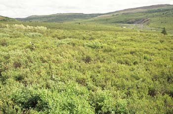
Seward Peninsula. Shrub site. (low shrub tundra) (C3) This site demonstrates zonal vegetation representative of the Council area. It is located on about a 5 degree slope with south-west aspect, approximately 1 km upstream from the mouth of Ophir Creek. Most of the land surface is covered by shrubs up to a meter and a half in height. The primary plant community is moist Betula glandulosa-Salix glauca-Hylocomium splendens. This type commonly occurs on moderately well-drained slopes in this area. Intermixed with the shrubs are clearings usually one to 5 meters. in diameter. The clearings predominantly consist of moist Pentaphylloides floribunda, Vaccinium uliginosum, Festuca altaica, Hylocomiumsplendens, and Salix reticulata. (photo by Jason Beringer) |
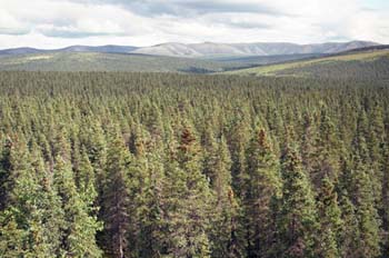 |
Council
Forest site (C1) |
 |
Council
Tundra site (C2)
|
| Council Tall Shrub Site | |
 |